
This is an old revision of the document!
Table of Contents
Aerial Archaeology: Roman Fort Castra Vetera I
Task: We will study the power of aerial photography and GIS for archeological prospection. The skills we will learn are
- how to georeference images such as photographed or scanned maps as well as aerial photographs,
- how to digitize elements from a georeferenced image.
Background: 2000 years ago the lower Rhine area played an important role in Roman history. The river was the border between the Roman empire (west of the Rhine) and ancient Germania (east of the Rhine). Much of the European history and its current way of life was strongly influenced by the Roman Empire and earlier the Greek and Middle East Empires.
North of modern Xanten was a major Roman city called Colonia Ulpia Traiana (CUT), which has been partly reconstructed. It is now the core of the Archaeological Park Xanten (APX).
South of modern Xanten, at the top of the Fürstenberg hill, was the important Roman castle Castra Vetera I. It was operated for several decades and modified several times. It is mainly known for its role in the Neronian phase, i.e. the times of emperor Nero up to 70 CE (CE: current epoque).
| Roman Settlements in Modern Xanten Area |
 |
| Medieval Xanten, Colonia Ulpia Traiania and Vetera I (by P. A. Faulkner). Source: http://intarch.ac.uk/journal/issue17/4/4.html |
| Castra Vetera I and Colonia Ulpia Traiana | |
 |  |
| Colonia Ulpia Traiana (by Dießenbacher Informationsmedien). Source: http://www.zeitreise-ruhr.de/chronik/060-roemerundgermanen.html | Castra Vetera I (by Dießenbacher Informationsmedien). Source: http://www.zeitreise-ruhr.de/chronik/060-roemerundgermanen.html |
 |  |
| Vetera I, secured ground plan (by Dießenbacher Informationsmedien) | Vetera I, reconstruction (by Dießenbacher Informationsmedien) |
 |  |
| Vetera I, Neronian fort, showing building numbers, kilns and fortifications of earlier forts (by P. A. Faulkner). Source and Legend: http://intarch.ac.uk/journal/issue17/4/4.html | Source: http://www.roemisches-rheinland.com/Wissen/Festes-Lager |
Exercises / Homework
1) Interactive Presentation of Roman History around Xanten
 Website currently not accessible!
Play with the interactive presentation The Xanten Area in Ancient Times: http://xanten.afg.hs-anhalt.de/desk30.html
Questions:
What was the Castra Vetera I and where was it located? Until when did it exist and what caused its abrupt end? Who were the Batavi? Which was their main settlement?
2) Georeference Maps and Images to Locate Vetera I
3) Aerial Archaeology
The Ruhr-Universität Bochum has an Archaeology department by which several projects had been performed to investigate ancient Vetera I. Read the web page presenting results of aerial photography around Vetera I: http://www.ruhr-uni-bochum.de/archaeologie/forschung/projekte/luftbildxanten.html.en
 |  |  |
| Fig. 1: The gate of the Neronian encampment. | Fig.2: “Streifenhäuser” along the east leading road. | Fig. 3: Traces of the eastern breastwork of the camp. |
| Source: Baoquan Song (Ruhr-Uni Bochum), Norbert Hanel (Uni Köln): http://www.ruhr-uni-bochum.de/archaeologie/forschung/projekte/luftbildxanten.html.en |
||
Where are these features located on the Fürstenberg? Try to georeference them.
Useful Files and Links
1) Revolt of the Batavi
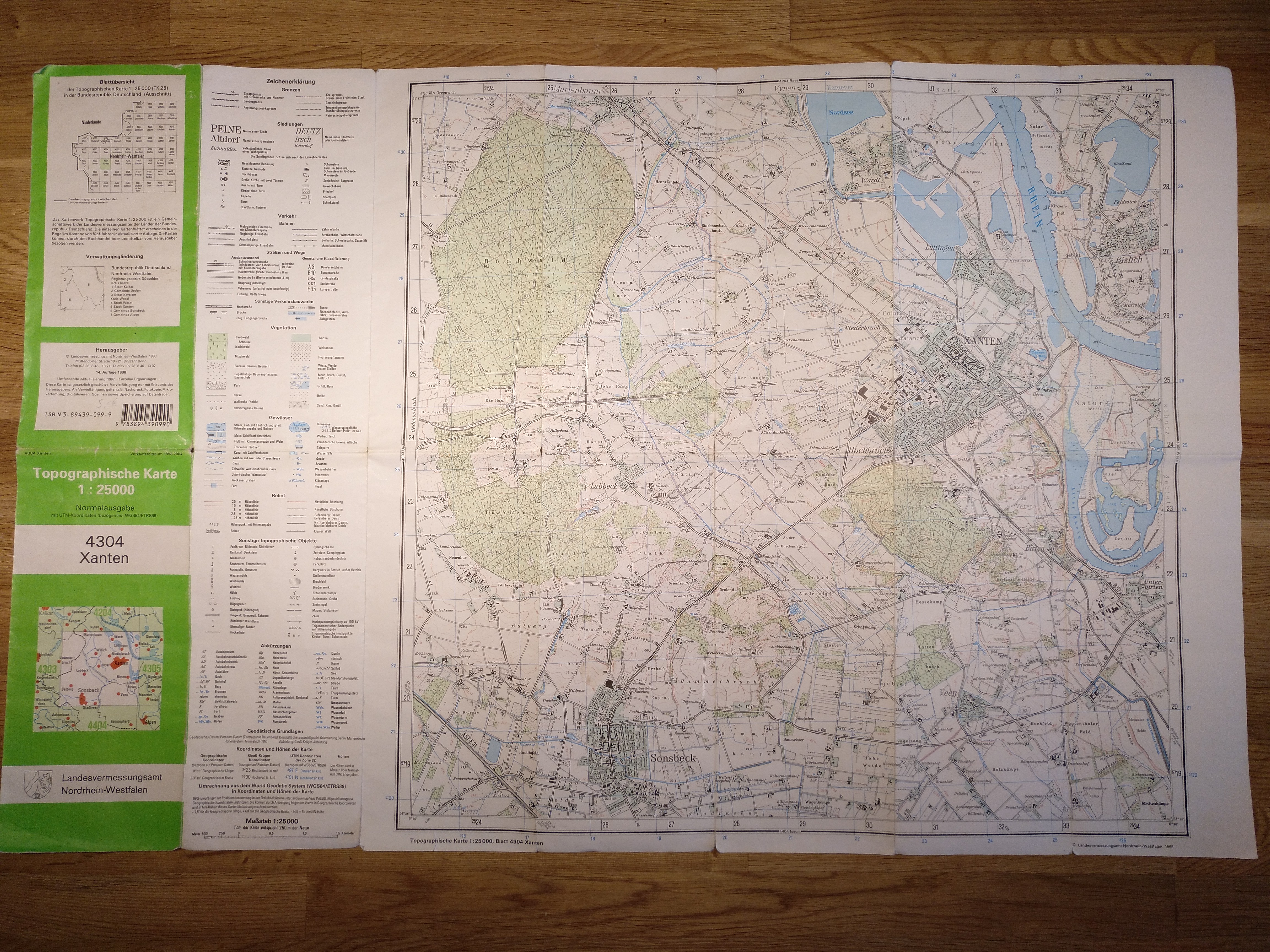
2) Photo of older German Topographic Map DTK25, No. 4304, Xanten, 14th edition, 1998
(DTK25: Deutsche Topographische Karte 1:25000):
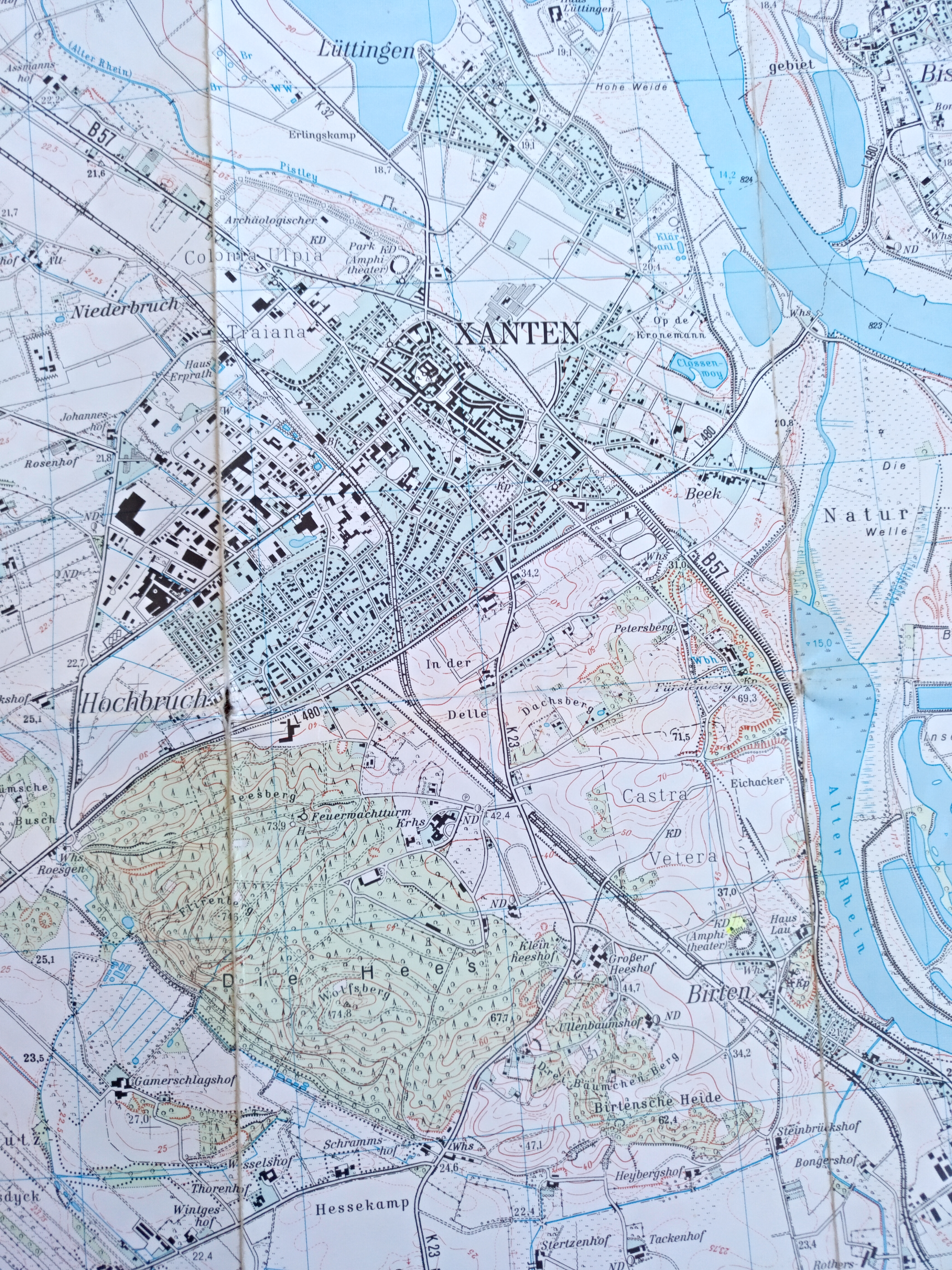
3) DTK25, No. 4304, Detail Fürstenberg
4) Castra Vetera I, secured ground plan and reconstruction
Vetera I, ground plan Vetera I, reconstruction Vetera I, secured ground plan. Vetera I, reconstruction